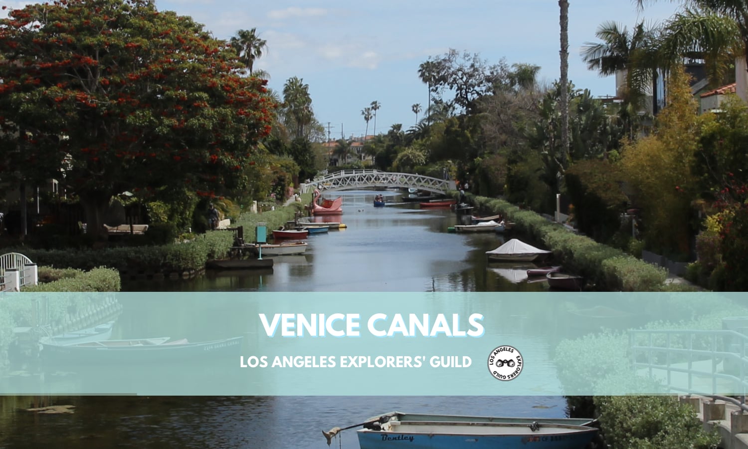
Venice Canals
Venice, California has a (somewhat) secluded series of networked canals, patterned after those of its namesake Italian city.
When most people hear the name Venice, they think of the Italian city famous for its network of canals, charging tourists a daily rate, and slowly sinking into the surrounding lagoon.
But when Angelenos hear “Venice,” most of the time they think of a coastal town famous for Venice Beach and the adjoining crowded boardwalk, Muscle Beach Gym, pricey shopping along Abbot Kinney Blvd, and a place to buy terrible tourist T-shirts.
But Venice, California, like its namesake Italian city, also has a series of canals.
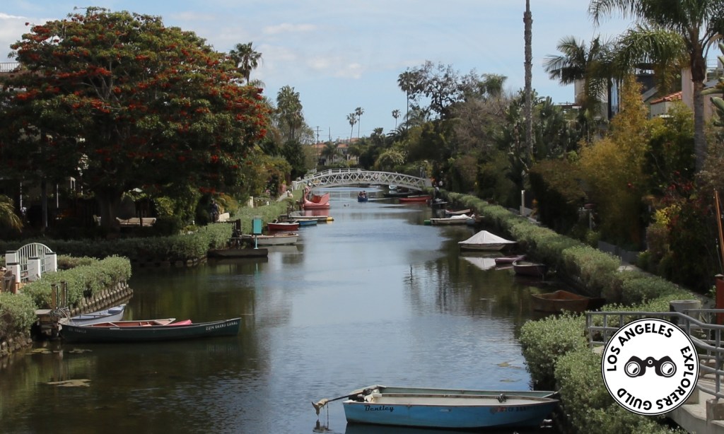
These canals are sort of hidden to the casual visitor, but these days anyone can see them quite easily with any online mapping tool:
A Brief History of the Venice Canals
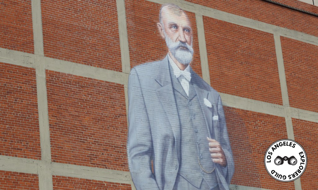
Back in the early 1900s, Abbot Kinney — tobacco magnate and he for whom the Boulevard is named — had a dream. He wanted to recreate Venice, his favorite European city, right in Southern California.
So he got to digging (though I’m sure he didn’t do it himself), and by 1905 the Kinney Company had excavated a series of 13 networked canals and filled them with water from the marsh that was on Mr. Kinney’s private land.
On July 4, 1905, Kinney opened Venice of America. For a number of years, it was a popular resort destination where visitors could relax in a gondola ride down the canals (paddled by an authentic Italian gondolier), shop at Venetian-themed businesses, or take a thrilling turn on “The Race Through the Clouds,” the first racing roller coaster on the West Coast. (It stood at the edge of the Grand Lagoon, roughly where Windward Circle is today.)
When Venice was annexed by the City of Los Angeles in 1924 (a few years after Abbot Kinney’s death), one of the first things they wanted to do was fill in Kinney’s canals and turn them into streets. People objected, of course. The resulting case went all the way to the Supreme Court, and the highest judicial power in the union ruled in favor of Los Angeles. By 1929, more than half the canals that made Kinney’s Venice of America, well, Venice, were paved over.
After that the canals were mostly ignored, and by 1940 those that remained were completely falling apart. With no funding and no one willing to repair them, the Venice Canals languished in decay for more than 40 years.
In 1983, the Cultural Heritage Commission designated remaining Venice Canals as Historic-Cultural Monument No. 270 under the name the Venice Canal System. That same year they were also added to the National Register of Historic Places with the same name. But it took another 10 years before the canals would be renovated and turned into the bucolic destination they are today.
The Latest Exploration …
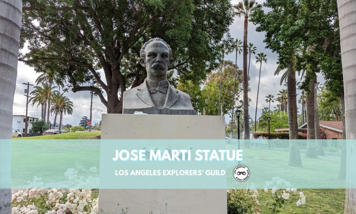
Jose Marti Statue
In Echo Park, right across the street from the Angelus Temple, you’ll find a statue honoring José Martí, the man known as the liberator of Cuba.
Keep readingThe Remaining Venice Canals
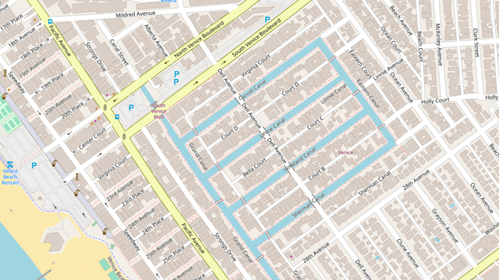
Today there are only six remaining canals. The Carroll, Linnie, Howland, and Sherman Canals all run roughly east to west. The other two canals — the Eastern Canal and the Grand Canal — border those four and run in a northerly-southerly direction with the Grand Canal being fed from Ballona Creek to the south.
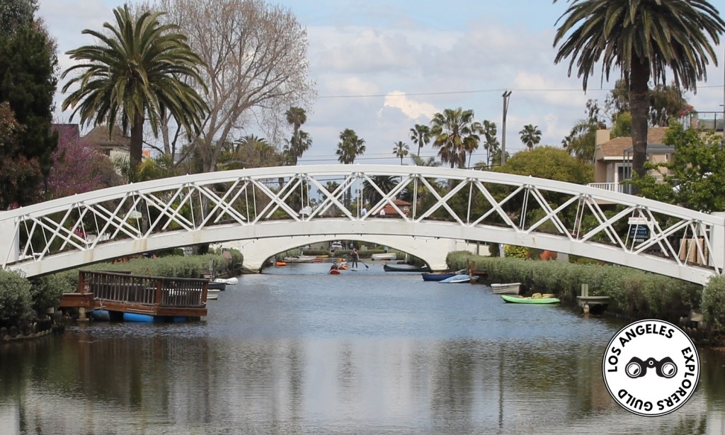
Walking around the canals is very relaxing adventure. The neighborhood is secluded from the surrounding car-based traffic, so strolling along the canals is a quiet affair. I’m not sure how long it takes to walk along every side of every canal, but it’s easy to spend an hour or more wandering around the serene walkways.
You’ll notice that almost every house includes a dock of some sort, and at least one small boat is moored to almost every dock. You’ll likely see and a few boaters out for a leisurely float — and maybe even a group of stand up paddle boarders if you’re lucky.
The canal neighborhood even has a tiny park inside its borders. Linnie Canal Park is located at at the corner of Linnie Canal and Dell Ave, but it’s mostly taken up by playground equipment geared toward young children.
The canal system has something like nine different pedestrian bridges that traverse the different canals, but getting around the neighborhood can be a little vexing. You can’t just cross the street in the middle of a canal, and figuring out how to get from where you are to where you want to go is sometimes challenging — at least until you understand how and where the walkways are connected to each other.
One of the aspects that makes the Venice Canals appealing is the lack of traffic. The only place you can drive through the canals is along Dell Avenue, the street bisecting the neighborhood and crossing the four east-west canals and connecting Venice and Washington Boulevards. Dell Ave features a bridge over each canal it crosses, and each of these bridges has a set of steps leading to the walkways along the canals below.
Getting to the Venice Canals
The easiest access to the Venice Canals is from either of two walkways from Venice Beach — one at 25th Avenue and the other at 27th Avenue. There’s also access from the east side on Carroll Court, Linnie Avenue, and Howland Avenue (each granting access to its similarly named canal).
The most obvious access path, though, is right from Dell Avenue at South Venice Boulevard. Although this is a route mainly for cars, it has what appears to be a bike lane along most of its length and offers the greatest number of access points to each canal. Dell is a one-way street with cars driving north toward Venice Blvd, but be careful as the street is very narrow.

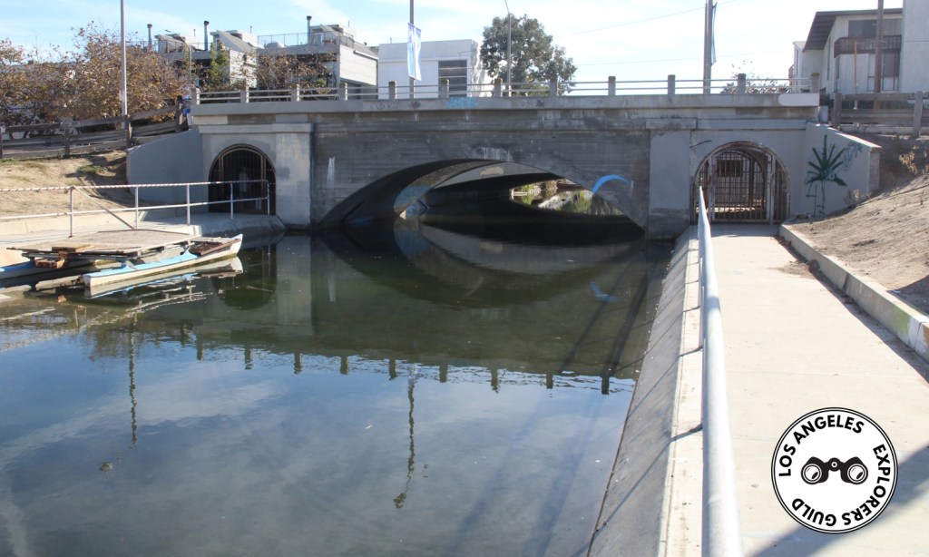
The Dark Side
As pastoral as the canals can seem, they also have a grim industrial side where the Grand Canal runs into the appropriately named Canal Street, under a Venice Blvd overpass. This just happens to be in a parking lot that’s a good place to leave a vehicle for an afternoon of canal exploration.
Venice Canals
- South Venice Boulevard & Dell Avenue, Venice, CA
- GPS Coordinates: 33.98575,-118.46761 [ Google Maps ]
- what3words: ///books.labels.tennis
- Parking in Venice is a challenge. We’ve always had good luck finding space in the lot at Venice Blvd & Pacific Ave. We recommend arriving early.
Thank you for visiting the Los Angeles Explorers Guild. If you’re enjoying our explorations of Los Angeles, please consider supporting us on Patreon or making a one-time donation via PayPal. We appreciate your support.
Our Most Recent Explorations