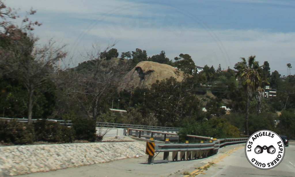
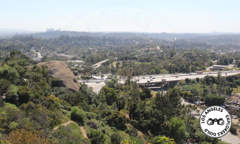
Anyone driving along the 134 through the city of Eagle Rock has seen this huge, rounded boulder looming above the northern edge of the freeway.
The Eagle Rock (the rock) is large sandstone formation, the result of hot springs activity millions of years ago, nestled on the northeastern edge of Eagle Rock (the city). When the sun is overhead, a formation on the southern side of the rock casts a shadow that looks a lot like an eagle (or any large bird of prey, really, but back in the day people went with eagle and it stuck) flying right out of the rock. And from a certain angle, the rock also resembles the head of an eagle in repose.

Eagle Rock, The City
Eagle Rock, the city, was named for Eagle Rock, the rock. The area of Eagle Rock, like much of the surrounding land, was one part of the Rancho San Rafael. The Rancho was subdivided in 1870 and the area that would become Eagle Rock was awarded to Benjamin Dreyfus, a German immigrant and would-be wine maker from Anaheim.
The city that sprung up in the shadow of the Eagle Rock was initially called Eagle Rock Valley and eventually incorporated as Eagle Rock City in 1911. But by 1923, the need for a steady supply of water forced the city to accept annexation by Los Angeles.
Eagle Rock, The Rock
The unique stone formation, typically known as “The Rock” by locals, has been called the Eagle Rock since at least 1888 and quite possibly earlier. But before that, the native Tongva people called it La Piedra Gorda (the fat rock).
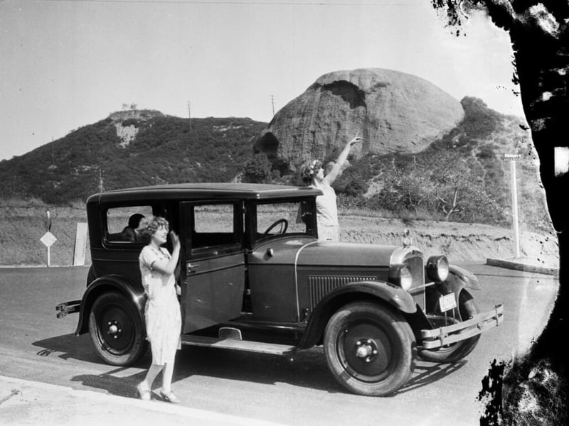
When Archduke Ludwig Louis Salvator visited in 1876, he drew the first picture of La Pierda Gorda. He later wrote of his journeys to America in his book titled Los Angeles in Südcalifornien. Eine Blume aus dem goldenen Lande. You can read a translation of it (without illustrations, sadly) as a PDF at the Library of Congress. The section about La Piedra Gorda is detailed starting on page 120.
The Latest Exploration …
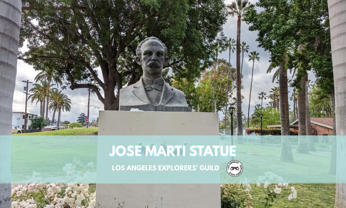
Jose Marti Statue
In Echo Park, right across the street from the Angelus Temple, you’ll find a statue honoring José Martí, the man known as the liberator of Cuba.
Keep readingOver the years, the Eagle Rock has served many functions — it’s been used as a home for the Tongva, a hideout for bandits (most notably the notorious highwayman Tiburcio Vasquez), and even a have for a reclusive beekeeper who lived in the caves of the rock and would wander down into town every few days to sell honey.
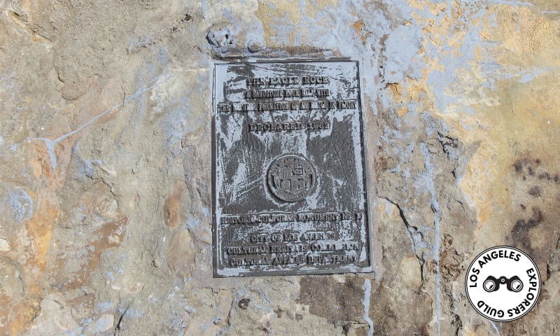
Starting in 1917, Easter services were held atop the Eagle Rock, and in later years youth groups would spend the night camping in the caves. But all that activity slowly dwindled after the the Eagle Rock was named Los Angeles Historic-Cultural Monument No. 10 way back in 1962.
Eagle Rock, The Monument
Curiously, even though the city declared Eagle Rock Historic-Cultural Monument in 1962, the Rock itself didn’t actually belong to Los Angeles until 1995.
The land around the rock — including the rock formation — was owned by developer Fredric Heim. And, in the waning years of the 1980s, Heim had an idea to build a sprawling apartment building at the base of the rock.
But Eagle Rock residents weren’t up for that nonsense. Members of the Eagle Rock Chamber of Commerce, along with the Lions Club and the Rotary Club, organized a grass roots campaign to convince politicians in Downtown Los Angeles that the good citizens of Eagle Rock (the city) were committed to keeping Eagle Rock (the rock) and the land around it free of development.
It took some time to sort the whole mess out (Heim sued when the city tried to claim the area under eminent domain), and Los Angeles eventually settled with Heim for a purchase price of $699,000 in 1995.
The area that Heim once owned beneath the Eagle Rock is now part of Richard Alatorre Park, named in honor of the former District 14 City Councilmember upon his retirement in 1999.
Eagle Rock, The Trail
Although you can walk right up to the base of the Eagle Rock from either Richard Altaorre Park or just off Eagle Rock View Drive, it’s very difficult to gain access to the top of the sandstone formation.
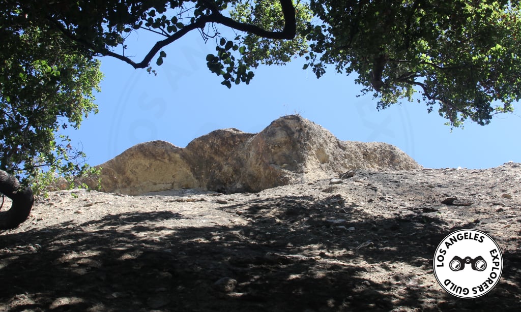
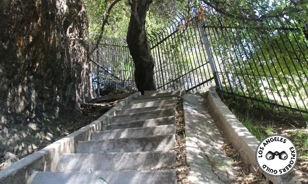
There used to be a set of stairs that allowed access to the top of the rock, but the stairs are in a dangerous state of disrepair and overgrown by vegetation. If you manage to push through, you’ll run up against an iron fence barring further access to the peak.
There’s a short hiking trail, known as the Eagle Rock Canyon Trail adjacent to the Eagle Rock that starts in Richard Alatorre Park. But it’s a narrow, poorly marked one-mile loop trail peppered with an abundance of “No Trespassing” signs posted along the trail which make for a somewhat confusing hike.
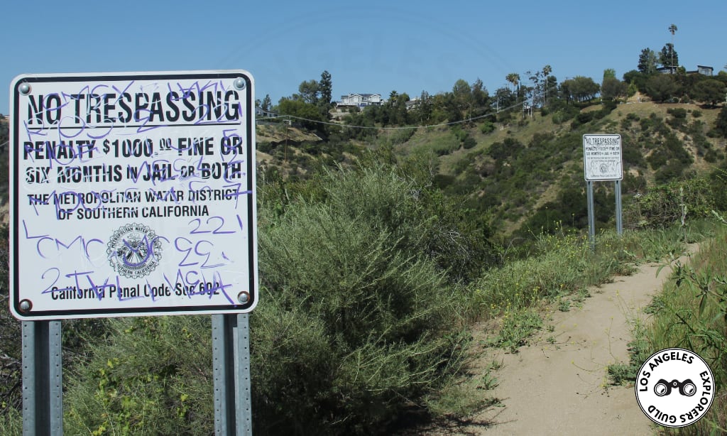
The trail is also not well-maintained and often encroached by poison oak. You understandably might think it’s the best route to get to the top of the Eagle Rock, but it’s not. Upon reaching the the trail’s highest point, you’ll find yourself above and a good distance behind the Eagle Rock.
If you’re an enterprising sort of explorer, you can probably figure out a way to climb up the Eagle Rock’s crest, but overall, this isn’t a particularly noteworthy hike.
If you’re looking for a good hike, you’d be better off heading to the Pasadena Hunt Club Memorial or the Dawn Mine.
The Eagle Rock
- 5475 Eagle Rock View Dr, Eagle Rock
- GPS Coordinates: 34.143112, -118.184002 [ Google Maps ]
- what3words: ///rust.employ.newly
Thank you for visiting the Los Angeles Explorers Guild. If you’re enjoying our explorations of Los Angeles, please consider supporting us on Patreon or making a one-time donation via PayPal. We appreciate your support.
Our Most Recent Explorations