The Center of Los Angeles
Whether it’s a Tootsie Pop, gravity, or consciousness, everything has a center — even the City of Los Angeles. This mystical location is known as Edwards’ Point, and it’s an easy place to visit.
Humans love to find the center of geographic locations. However the U.S. Geologic Survey (USGS), the the branch of the government responsible for mapping the country, doesn’t recognize “geographic centers” or provide a methodology for pinpointing them. But that doesn’t keep determined cartographers from employing unorthodox techniques to plant their flags.
The Center of Los Angeles is marked thanks to the inventiveness and geographic expertise of one Allen E. Edwards, former employee of the the USGS and past guide in Franklin Canyon Park. To ascertain the center point of Los Angeles, Edwards envisioned the city as a plane, found the balance point, and declared this spot as the city’s center.
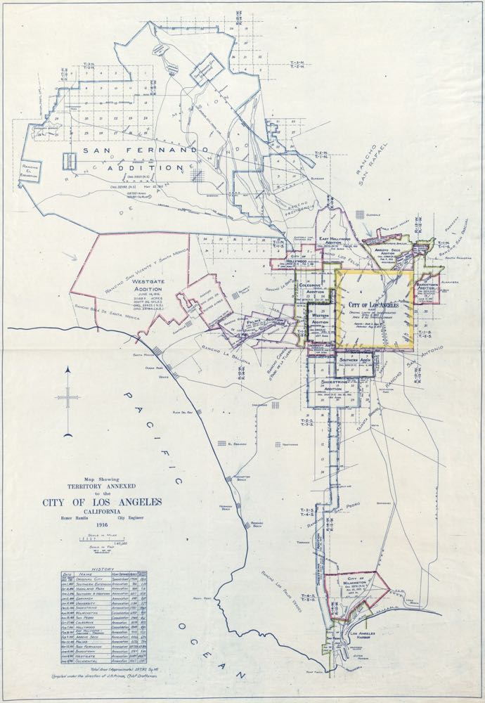
Now , if you’ve ever seen the city of Los Angeles on a map, you’re probably wondering just how Mr. Edwards found the exact center of this oddly shaped mass of geography. If you haven’t seen the Los Angeles on a map, it looks like this:
Finding the Center of Los Angeles
As the story goes, Edwards took a 4-foot by 6-foot AAA map of Los Angeles and cut out the city along its edges. Then he glued the excised shape to a sheet of foam core, trimmed it to match the city’s border, and placed it on top of a vertical pin in different spots until the contraption balanced. Once that was done, he transferred that balance point to its corresponding location a USGS topographic map.
The Latest Exploration …
Jose Marti Statue
In Echo Park, right across the street from the Angelus Temple, you’ll find a statue honoring José Martí, the man known as the liberator of Cuba.
Keep readingThat spot, now known colloquially (and appropriately) as Edwards’ Point, had the coordinates of 34° 07′ 31″ north latitude and 118° 23′ 56″ west longitude. This placed the city’s center in the northern portion of the 605-acre expanse of Franklin Canyon Park, a natural space adjacent to Beverly Hills, Bel Air, and Studio City. At least that’s what Edwards claimed.
Chalk it up to continental drift, limited significant figures in the results, or some well-meaning deception on Edwards’s part, but the above coordinates fall on a spot about a half-mile to the east of where Edwards declared his center point was.
That means if you were to travel to those coordinates, you’d end up in someone’s backyard. However, thanks to modern technology and a little old-fashioned dead reckoning, I’ve added updated coordinates below.
A Journey to the Center of Los Angeles
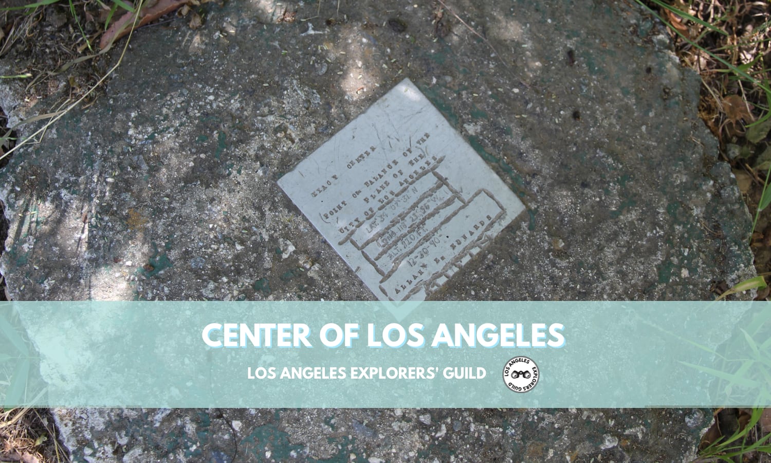
The Center of Los Angeles doesn’t seem to have an official designation, but the spot is marked by an unassuming and somewhat haphazardly hand-stamped plaque embedded in concrete marking it as the “Exact center, point of balance of the plane of the City of Los Angeles.” It’s dated12/30/1990, lists the original coordinates, and is stamped “Allan E. Edwards.”
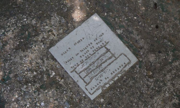
You can find the plaque under a smallish oak tree just past the borders of the Franklin Canyon parking lot along the park’s Chaparral Trail.
I’m not sure his methodology was completely sound, but the late Mr. Edwards did work for the USGS, so it’s a fair bet he knew his way around a map. But he also worked as a Franklin Canyon docent for the Mountains Recreation and Conservation Authority, so one could be forgiven for voicing any skepticism regarding the impartiality of Mr. Edwards’s findings — especially considering the deviation of the given coordinates from the plaque’s placement.
Even if finding strange geographical quirks isn’t your thing, this spot is still a cool place to explore to see some wildlife in the middle of a bustling metropolis. The park has also played host to countless locations in film and television from Bonanza to Dynasty to Sons of Anarchy. It’s also notably the stand-in for Glastonbury Grove, the entrance to The Black Lodge in Twin Peaks.
Visit the Mountains Recreation & Conservation Authority’s Franklin Canyon Park site for directions, maps, and birding checklists.
One final note. Edwards’ Point is the center of Los Angeles proper, not the entire vastness of Los Angeles County.
The Center of Los Angeles
- 2600 Franklin Canyon Drive, Beverly Hills
- GPS Coordinates: 34.12448, -118.40778 [Google Maps]
- what3words: final.gently.pillow
Thank you for visiting the Los Angeles Explorers Guild. If you’re enjoying our explorations of Los Angeles, please consider supporting us on Patreon or making a one-time donation via PayPal. We appreciate your support.
Our Most Recent Explorations